
Last Sunday (19th April), I slept through my early alarm as I hadn't been able to get to sleep until sometime well after 3am. As it was, I had to decide whether to take the train up to Douliu in Yunlin County to take more pictures of the new Hushan reservoir or make a return trip to Tseng-wen reservoir to better observe the things I had noticed last time out. That's what I chose to do; the return trip to Yunlin County must wait until another time. I left Tainan city late - something like 12.45pm and made my usual stop at the general store in Yujing township before heading off through Nanxi district to the reservoir, only this time, rather than follow the main road up toward the south end of the reservoir and then along its' twists and turns to Dapu, I went straight to the forward tollbooth to approach the downstream face of the dam. What I wanted to do was to observe the current state of the re-engineering taking place. Since I was last here, two entirely new tunnel mouths have been bored into the side of the mountain for the new sluiceway...
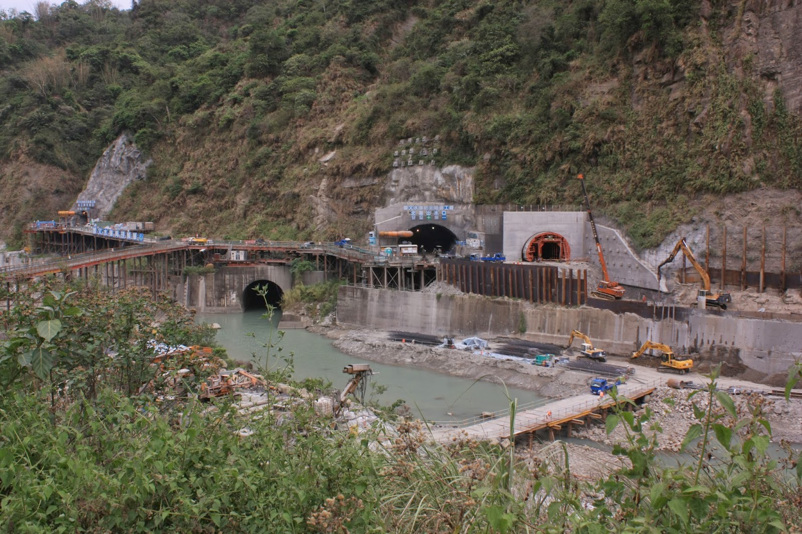 |
| Two new sluiceway tunnel mouths to the right, with one of the existing sluicway mouths to their immediate left. |
Although there are two new exit mouths here, the tunnels behind them conjoin after a short distance to form a single shaft which penetrates through the mountainside at an angle for approximately one kilometer...
 |
| Public sign outlining the planned new sluiceway and its' location vis-a-vis the reservoir's existing sluiceway. |
 |
| A sidelong look at the new sluiceway under construction. |
 |
| Overlooking the immense water chamber behind the spillway gates at the top of the dam; what little rain we've had recently has been nowhere near enough to alleviate the ongoing depletion of Taiwan's largest reservoir. |
 |
| Construction of the new sluiceway tunnel on the upstream side. |
 |
| Another view of the upstream side of the new sluiceway construction work. |
 |
| Looking out across the south-west corner of the reservoir; this stretch of water is itself larger than most other reservoirs in Taiwan, but is only a fraction of Tseng-wen's total size, as it bends around that distant corner to the left. |
 |
| Peering around that left corner: the reservoir extends northward by about twelve kilometers. |
 |
| A view through the 300mm: the mudflats appeared to have reached further south since my last visit. |
 |
| The wild boars are now gathered together on the south-facing shore of that spit of land in the reservoir's approximate centre. When full, all of that land is submerged under fifteen to twenty meters of water. Much of it was submerged as recently as a month ago. |
.JPG) |
| I left the south end of the reservoir to get back onto the main road running around the eastern side; but before I left, I caught sight of a couple of crested serpent eagles, which are now a rarer sight than usual. |
 |
| Overlooking the center of Tseng-wen reservoir and the little bay with which I have become so familiar over the last few months. |
 |
| The western shoreline with the dotted black specks being the wild boars, and the white-roofed structure off to the left being the floating barge which is the furthest south I've ever seen it. |
 |
| Fisherman's boats and pontoon rafts crowded round at the little bay. |
 |
| The central ravine on the western shoreline with its' research station and associated vessels. I believe there are actually very few people staffing that place at any one time. |
 |
| The other tributary mouth further to the north - I had approached this on the water just last weekend, but it is now almost entirely dried up. |
After driving around the eastern side of the reservoir and taking pictures from the center-point, I knew that I had to go and investigate the crane I had seen last time and see what that was all about I remember a diagramI had seen sometime last year in which a snaking red line was drawn through the length of the reservoir toward the dam from a point just south of Dapu village at the reservoir's northern end. The crane is at exactly that sight just south of Dapu. My guess at the time, though I couldn't be sure, was that the red line represented a pipeline that would be used to flush sediments from the back of the reservoir toward the front.
 |
| The construction site just south of Dapu village; a slope is being carved out and a series of large canisters placed behind it and a hangar-like shed off to the right. It will be interesting to see how construction progresses here over the coming months. |
 |
| The apex of the slope with the canisters behind it. |
To take the pictures immediately above, I had wandered down onto a small farmer's road until I reached a barrier behind which were a series of long-since abandoned and now derelict houses. I followed the winding path between them on foot and was able to spy out the construction site from between the trees. After a short while the path twisted to the left along the edge of the eastern shoreline, bringing me face to face with the extent of the mudflats' progress since last weekend; where they had then still lain some way off in the distance, they were now encroaching right up to my previous observation point over on the western shoreline...
 |
| The now dried up tributary mouth is visible on the other side, surrounded by the encroaching mud as the water has vanished. |
I followed the path further along, curious as to whether it would eventually lead me down to the water's edge and a new site from which to launch the boat. Along the way however, I got lucky when I ran into my old friend the Black Kite (along with several other Kites), who was fishing in this corner of the reservoir. Out came the 300mm and I started snapping away,,,
Below is the steep-sided bay into which the little path had brought me when I met up again with the Kites...
 |
| Looking southward from the steep-sided bay. |
Once I'd spent my time hanging out with the birds, I left the little path and headed back up the farmer's road which eventually led me into the south end of Dapu village, from which I was able to follow another small road down to the construction site I had observed earlier...
 |
| The crane standing over the slope. |
 |
| Looking down into the slope itself. |
 |
| A set of pressurized gas bottles in the yard behind the slope. |
 |
| One of the canisters was placed beneath the hangar; it has a lip on one side, which makes me wonder whether it is designed to be fitted to another one as in a section of pipeline. |
 |
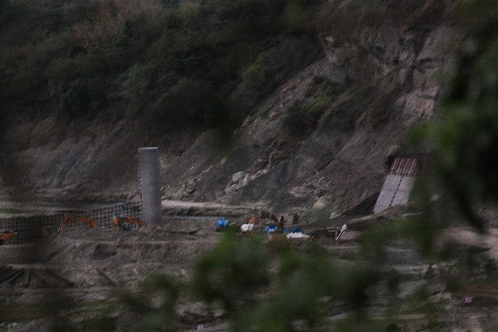
| The public notice attached to the construction fence relates that this project is part of the ongoing construction of remedial facilities at Tseng-wen reservoir but is no more specific than that, and thus not very informative. Indeed the diagram on the right is of the new sluiceway tunnel at the front of the reservoir next to the dam which is about ten kilometers away to the south. |
 |
| Further down from the construction site, the roughly paved road led down to a little harbour which would be an excellent alternative site from which to launch boats. |
I left the construction site behind and headed off to the Dapu 7-11 for something to eat and drink (note to self: by the late afternoon, all of the food is gone, leaving only packets of crisps behind so bring food along next time). Once I had refuelled, I drove out of Dapu to go and see the construction site for the new weir-like structure which seems to be intended to trap sediments. Though I was denied access to the site by the security guard, he did answer my questions (he used a new term in Mandarin I'd never heard before which I haven't yet had written down for me). What I had wanted to do was photograph the site from the south side of the river looking north toward the mountainside, but I wasn't going to be allowed to do that. Instead, I drove over the bridge across the river...
 |
| There was still water flowing through the river bed, even at this late stage during the drought. |
... and managed to get a partial view of the north side of the river through the trees as the light was fading...
 |
| The second tower to the left and the new, north-side box to the right. The image is blurry because the light was fading and I had forgotten the camera-fastener for my tripod. |
 |
| The two towers in the middle of the river, with the north-side box off to the right. This is where future sediments are going to be trapped, if the new structure works correctly. |
I also drove upstream to take a look at the weir over which the Tseng-wen river falls on its way down from Chiayi County's Alishan district...
 |
| The weir upstream from the back end of Tseng-wen reservoir; there was still a fair amount of water flowing over it. |

.JPG)
.JPG)
.JPG)
.JPG)
.JPG)
.JPG)
.JPG)
.JPG)
.JPG)
.JPG)
No comments:
Post a Comment
Comment moderation is now in place, as of April 2012. Rules:
1) Be aware that your right to say what you want is circumscribed by my right of ownership here.
2) Make your comments relevant to the post to which they are attached.
3) Be careful what you presume: always be prepared to evince your point with logic and/or facts.
4) Do not transgress Blogger's rules regarding content, i.e. do not express hatred for other people on account of their ethnicity, age, gender, sexual orientation or nationality.
5) Remember that only the best are prepared to concede, and only the worst are prepared to smear.