A week ago today (Sunday April 5th), I returned to Tseng-wen reservoir on a gloriously bright morning to take some more observations and get better photographs than I did last time out. These days I'm often too busy to write up blog posts about my reservoir work until it's getting a bit late (this has been especially true of the last couple of weeks and will probably be the case for the next month or so). As it is I can't even remember what time I left Tainan city and what time I arrived at Tseng-wen reservoir - it was probably around nine in the morning when I arrived judging by the light in the picture below...
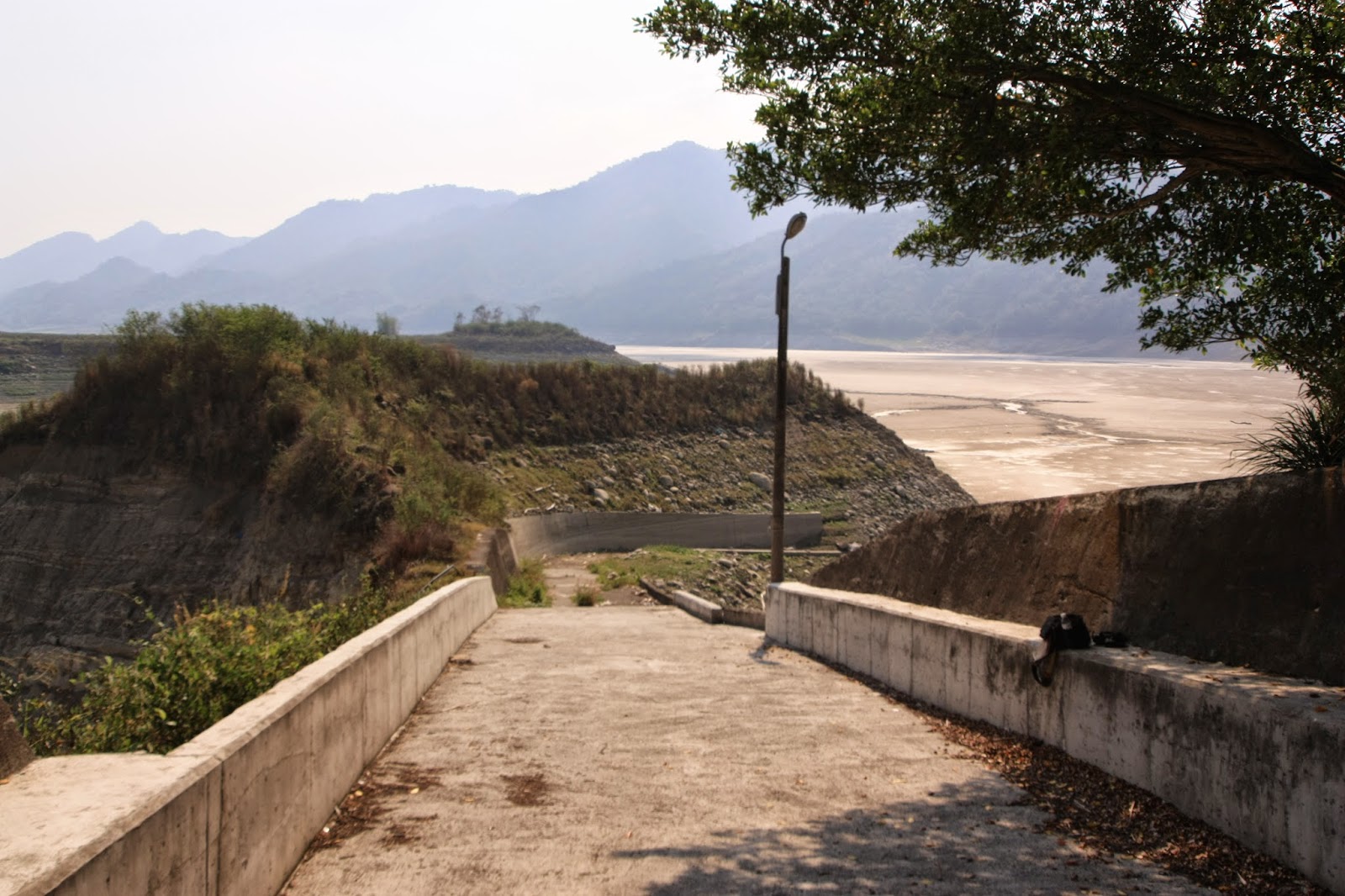
This is the southern quarter of the reservoir which runs up against the actual dam and as you can see from the treeline along the banks (and the waterline along the dam), the water level has fallen some good fifteen to twenty meters from its' maximum extent. This was also my last day with the recently regrown beard before I shaved it off...
The first of the new data this trip yielded (which was impossible last time out due to the dense fog) was an observation of the new sluiceway construction work being undertaken to the south of the water intake tower...
 |
| In profile: the dam with two of the three spillway gates off to the right, the dam, the water intake tower to the left and the the new construction for the sluiceway modifications off to the far left. |
 |
| Close up of the water intake tower and the new sluiceway construction. |
 |
| Close-up on the new construction itself. |
 |
| Overlooking the approximate centre of Tseng-wen reservoir from the east (image taken with phone camera); the little bay in the foreground is where I was headed and there were already people camping and fishing there. |
 |
| Arrival at the little bay. |
 |
| The little blue truck at the end of the bay belonged to a couple of locals sat there fishing. |
 |
| My take-off point: notice the wooden raft I had swam back with a month ago lodged up on the rocks to the top left - the water has fallen some five meters or so since then. |
 |
| The same rocky shore taken from further back to provide more context - back in February, half of this was still submerged. |
 |
| The lower water level meant I had an easy time of following the "road" down to the water's edge to get my boat ready. |
 |
| Footprints in the mud - possibly mine and those of Gary and Howie from our trip two weeks previously. Those footprints indicate the area where we would have entered the water with our boats. Note the distance from those prints to my kit at the end of the "road". |
 |
| Finally, back out on the water: looking northward just off the eastern shoreline. |
A curious thing happened after a short while of following the eastern shoreline northward; a Black Kite descended to just a few feet or so above me to circle me overhead again and again, checking me out. However, because my usual encounters with these birds require the use of the long lens - that is what I had attached to my camera and as a result I could not get a single shot off because the bird was actually too close! Had I had the 10mm wide-angle lens attached, I might have managed something decent. This is the first time this has happened.
 |
| After a scorching hot hour in the crossing I eventually arrived at a point well to the north of previous landing spots on the western shoreline. |
 |
| This large gap in the western shoreline admits a small feeder stream into the reservoir. It is very popular with both the kite and the egrets which either means that there are more fish to be had here, or just that the water is shallower and thus the fishing that much easier for the birds. |
.JPG) |
| The Kite who had circled me overhead during the crossing; I hoped to get more and better shots of him. |
 |
| The hot sun necessitated that any waiting around must be done in the shade, which I found beneath a massive boulder. |
 |
| The stream mouth. |
.JPG) |
| My friend the Kite returning to the stream once more; I was to be unable to get any better shots of him. |
 |
| The western shoreline this far north forms a short, steep cliff down into the water. |
 |
| The same view as above but tilted slightly further to the north - the peak in the distance stands over the bend in the reservoir toward the east whence it is fed by the Tseng-wen river winding down out of the mountains further east in Chiayi's Alishan district. |
 |
| Myself, with the lens looking directly north. Behind me in the distance the mudflats are just visible, as the first part of the reservoir opposite the village of Dapu has already dried up. |
 |
| The start of the "mudline" in the distance. |
 |
| Looking eastwards to the area just south of Dapu village; I was curious as to what the crane is for (and remain so as later on I forgot to check it out on my way back). |
 |
| Small residences in a village across the reservoir from Dapu. |
 |
| Back on the boat, I initially pushed further northward to take a little peek up the tributary stream. |
 |
| On the boat looking directly southwards; it was a brilliant day. |
 |
| Looking eastward on my approach back toward the eastern shoreline. |
 |
| Looking back northward. |
 |
| Finally, I rounded the edge of the eastern shoreline and returned back into the bay. When I had swam back across the reservoir on March 8th, this rocky outcrop was submerged, and I had briefly stopped swimming to stand on it and take a break before completing my swim by crossing the bay. |
.JPG) |
| Looking eastward down into the bay. The tree-clad cliffs opposite are where the road (provincial highway 3) overlooks the middle of the reservoir with spectacular views. |
Once I was back on dry land and into a change of clothes, I headed off further north to Dapu to observe the extent of the drought right at the back end of the reservoir...
 |
| Looking down into an empty reservoir bed from a height of twenty meters or so. When full, that is a vast amount of water. |
 |
| Looking northward across the eastward bend in the reservoir; there is a tiny little hamlet on the other side. |
 |
| The road that leads down into the reservoir from Dapu; I have previously been here when the water level was so high that the lamp on top of the lampost was only a few feet above it. |
 |
| Following the road down into the reservoir's bed. |
 |
| The mudflats on the bed. The further across them you walk, the moister and squishier they become and the more you sink. |
 |
| Looking back at the road down into the bed from Dapu. |
 |
| When the water level is this low, what water remains becomes concentrated in two little streams on either side of the kilometer-wide bed. This one is on the eastern side, but the one on the western side is too far away to be visible in this shot. |
 |
| Looking back westward around the bend. |
I stopped in Dapu for something to eat and drink before heading out again; naturally I wanted to do everything, but there simply wasn't time for that. Once out of Dapu and across the bridge, I turned left rather than right. This meant that I did not get to see the big weir during the drought. It also meant however, that I was to obtain new data: the structures at the back of the reservoir which I had previously thought abandoned were clearly not. Even though they had been there for a couple of years, it seems that the Water Bureau people were waiting for the drought to lower the water level to such an extent as to allow construction to recommence. The coffer dam has been extended and a third structure (a second tower) has been added...
 |
| Three structures now, rather than two. I suspect that this is going to be a weir of some kind intended to trap sediments brought down by the river during typhoons. |
 |
| There are now steel cables running between the block on the south side and the first tower in the middle, and there is also a steel latticework structure between the first tower and the second tower on the north side. |
Pleased with this new data, I drove on up the road and followed a little detour to take me to the hamlet opposite Dapu. Long before I reached that hamlet, I was greeted with this view out over the reservoir from the north looking directly south...
 |
| The village of Dapu is off to the left, and you can even see the curves of the little road that leads down from Dapu into the reservoir bed. |
There is another tributary river which feeds the reservoir and which must be crossed before you can reach the little hamlet opposite Dapu. It has an unusual weir to check its' flow during typhoon season...
 |
| A parting view overlooking the little bay in the middle of Tseng-wen reservoir late on in the afternoon. |
Pleased with the new data, and the experience I had out on the water again, I headed home feeling quite tired. I can't wait to go back again and learn more.


No comments:
Post a Comment
Comment moderation is now in place, as of April 2012. Rules:
1) Be aware that your right to say what you want is circumscribed by my right of ownership here.
2) Make your comments relevant to the post to which they are attached.
3) Be careful what you presume: always be prepared to evince your point with logic and/or facts.
4) Do not transgress Blogger's rules regarding content, i.e. do not express hatred for other people on account of their ethnicity, age, gender, sexual orientation or nationality.
5) Remember that only the best are prepared to concede, and only the worst are prepared to smear.